Greater Manchester Walks

There's miles of fine footpaths and walking trails to try in this county. Highlights include the Peak District National Park where you can visit the hugely popular Dovestone Reservoir on Saddleworth Moor. There's also the epic Trans Pennine Trail which visits some of the lovely countryside of the county.
Use the filter to show walks of a certain type such as woods, reservoirs, hills, long distance, country parks, canals and rivers.
In the spring walkers flock to the beautiful bluebell woods in the Greater Manchester area. Click the 'Woodland' button below to see these.
Use the links to view full route information including elevation profiles, interactive maps and GPS downloads.
You can also view an overview map of all the routes in the using the Greater Manchester Walk Map>>
*New* - Walks and Cycle Routes Near Me Map - Waymarked Routes and Mountain Bike Trails>>
| Filter: |
| Route Name | Photo | Distance | Description |
| Alkrington Woods | 1.2 miles (2 km) | This walk visits the pretty Alkrington Woods Nature Reserve in Middleton, Greater Manchester. View Full Details>> | |
| Ashton Canal | 5.9 miles (9.5 km) | Enjoy a waterside walk or cycle along this 6 mile long canal in Manchester. The canal runs from central Manchester to Ancoats, Bradford-with-Beswick, Clayton, Openshaw, Droylsden, Fairfield and Audenshaw before finishing at Ashton-under-Lyne where it meets the Huddersfield Narrow Canal. Walkers and cyclists can enjoy the whole route along the towpath. National Cycle Network Route 60 runs along the first section of the canal and a local cycle route takes you the rest of the way. Along the way you'll pass 18 locks, Manchester City Football Stadium, Manchester Velodrome and Philips Park. You can take short detours from the canal to visit some nearby attractions too. For example at Audenshaw you could head just south of the canal and visit Debdale Park and enjoy a walk around Gorton Reservoir. At the velodrome you can take a short trip north of the canal and visit Clayton Vale where there is a nature reserve with miles of walking trails and some great mountain bike trails. To extend your walk you can continue along the Huddersfield Narrow Canal in Ashton-under-Lyne. View Full Details>> | |
| Ashworth Valley | 5 miles (8 km) | This circular walk explores the Ashworth Valley area of Rochdale. On the route you'll enjoy riverside paths, woodland trails, attractive countryside and hill climbs with fine views over Manchester. The walk starts in Norden on the western fringes of Rochdale. Here you can pick up the Rochdale Way and follow it south along the Naden Brook through Ashworth Wood. You continue through Carr Wood where you will pass a pretty waterfall and lots of bluebells in the spring. The route continues south through Gelder Wood and Bamford Wood before coming to Simpson Clough. Here you turn north west to follow the pretty Cheesden Brook to Heywood's Farm and Greengate Hill. This section climbs high above the valley to expose you to some fine, far reaching views over the surrounding area. At Greengate Hill the route then turns east along the Rochdale Way to return you to Norden where the walk finishes. It's easy to extend the walk if you have time. You could head a short distance north of Norden to visit Greenbooth Reservoir or follow the Rochdale Way north west to Ashworth Moor Reservoir. Here you'll find the 18th century Owd Betts pub which is a great place for refreshments after your walk. View Full Details>> | |
| Audenshaw Reservoir Walk | 3.7 miles (6 km) | This walk uses waymarked walking trails to visit the Ashton Canal and the Gorton Reservoirs in Audenshaw, Manchester. It's a nice waterside walk, taking place on largely flat trails. The walk starts from the Guide Bridge train station which is right next to the canal in Audenshaw. You can pick up the towpath and follow it west toward Fairfield. Here you pick up the Tameside Trail and follow it south towards the reservoirs. You'll pass along the Upper and Lower Gorton Reservoirs before coming to Debdale Park where the route finishes. View Full Details>> | |
| Blackleach Country Park | 1.2 miles (2 km) | This country park in Walkden has nice footpaths to follow around the lake and through woodland. It's a nice peaceful place to visit with lots of birdlife to look out for on the lake. These include Herons, Tufted Ducks, Goosander, Water Rail, Coots and Moorhen. There's a car park and visitor centre where you can pick up the lakeside trail. You can also come by public transport as Walkden train station is only about a mile away. This route is designed for walkers but a cycle route runs through the northern end of the park. National Cycle Network Route 55 also runs close to the park. You could follow it from the centre of Manchester, through Salford and Roe Green to Walkden. If you feel like extending your walking in the area then you could head to the nearby Moses Gate Country Park. It's only a couple of miles to the north and covers 750 acres with a number of nice cycling and walking trails. View Full Details>> | |
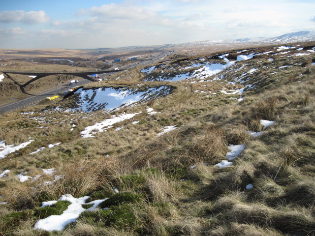
| Blackstone Edge | 2.5 miles (4 km) | Climb to this gritstone escarpment in the Pennine Hills and enjoy wonderful views over Greater Manchester and Yorkshire. The high point stands at 1,549 feet (472 m) with Manchester city centre, Winter Hill and the mountains of north Wales visible on a clear day. You can start your walk from the car park near Blackstone Edge Reservoir. From here you can pick up the Pennine Way and follow it to the summit. If you continue south along the path it will take you to Rock Stones Hill and Green Hole Hill. Heading north will take you to White Holme Reservoir, Warland Reservoir, Langfield Common and Withens Clough Reservoir. View Full Details>> | |
| Bollin Valley Way | 24.9 miles (40 km) | Follow the River Bollin from Macclesfield to Partington on this delightful waterside walk through Greater Manchester and Cheshire. The walk starts at the Macclesfield Riverside Park and follows the river through Prestbury, Wilmslow, Hale and Bowdon to Partington on the Manchester Ship Canal. On the route you will pass the 18th century Grade II listed Mottram Hall and National Trust owned Dunham Massey. This Georgian House is set in a magnificent 121-hectare (300-acre) deer park and boasts Britain's largest winter garden. View Full Details>> | |
| Bolton Rotary Way Footpath | 49.7 miles (80 km) | Enjoy industrial heritage, reservoirs, historic estates, memorials and country parks on this circular walk around Bolton. The walk visits Adlington, West Houghton, Blackrod and Farnworth. Walk highlights include Jumbles Country Park and Rivington Reservoirs, Blackleach Country Park and a waterside stretch along the Leeds & Liverpool canal. View Full Details>> | |
| Bridgewater Canal Way | 37.9 miles (61 km) | A walk along the Bridgewater canal, through Cheshire, Greater Manchester and on into Lancashire. The route passes Salford, Trafford, Altrincham, Manchester, Warrington and Halton. Along the way you'll pass a series of nice parks including Dunham Massey, Worsley Woods and Sale Water Park. View Full Details>> | |
| Burrs Country Park | 1.9 miles (3 km) | This walk takes you around the pretty Burrs Country Park, situated on the River Irwell just north of Bury. Habitats in the park include woodland, open space, wetland, ponds and waterways. You can follow a circular walking trail along the river before heading through Walmersley on the other side of the park. It's about a 2 mile walk so should take under an hour. There's good facilites too with a car park, a visitor centre and a cafe. View Full Details>> | |
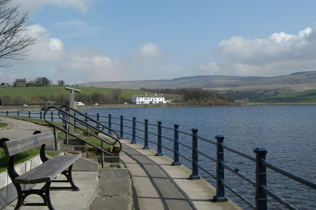
| Bury | 4 miles (6.5 km) | A circular walk around Bury, taking in the River Irwell, two reservoirs and the Manchester, Bolton and Bury Canal. There's nice, easy waterside paths and some great views of the surrounding Pennine Hills to enjoy on the way. The walk starts in the town centre just to the west of the train station. Here you can pick up the Irwell Sculpture Trail and follow it south and then west to reach the Manchester, Bolton and Bury Canal. Follow the towpath south towards Radcliffe before turning right to Crow Trees Farm and Withins Reservoir. Follow the paths on the right on the reservoir and they will lead you to the larger Elton Reservoir. It's a lovely spot with nice views across the water to the rolling hills beyond. Continue north past the reservoir and you can pick up the Daisyfield Greenway which will take you back into the town centre. View Full Details>> | |
| Castlefield National Trust Railway Walk | 0.1 miles (0.1 km) | The Castlefield National Trust railway walk is Manchester's premier urban sky garden, offering a unique blend of industrial heritage and modern horticulture. View Full Details>> | |
| Castleshaw Reservoir | 1.9 miles (3 km) | These two reservoirs in Oldham have some nice walking trails to try. It's a beautiful setting with the Upper and Lower reservoirs surrounded by some lovely Pennine scenery. You can start the walk from the Castleshaw Centre public car park on Waterworks Road, Delph. It's located at the southern tip of the lower reservoir. From here you can pick up paths along the lower reservoir before another footpath takes you around the upper reservoir. It makes for a nice circular walk with good views across the water for the duration of the route. On the eastern side of the lakes you could also explore the ancient remains of the Castleshaw Roman Fort. To extend your walking in the area you can pick up the Pennine Bridleway and further explore Saddleworth Moor and Delph Heights. You could follow the long distance trail north and head to the nearby Dowry and Readycon Dean Reservoirs for example. The Oldham Way, Crompton Circuit and Rochdale Way also run through the area. They're all good options for reaching several of the other reservoirs dotted around this area of the Pennines. This includes Ogden and Piethorne Reservoirs located just 2.5 miles north west of Cattleshaw. The reservoir sits on the edge of the Marsden Moor Estate where there are some splendid walking trails. View Full Details>> | |
| Chadkirk Country Estate | 1.9 miles (3 km) | This pretty country park is located on the River Goyt near Marple. The estate includes a 60 acre farm, an old orchard, a walled garden, peaceful woodland and a 16th century chapel with an audio visual presentation on the history of the site. The Etherow Goyt Valley Way runs through the park so you can continue your walk through the beautiful Goyt Valley on this trail. View Full Details>> | |
| Cheesden Valley | 8.1 miles (13 km) | This circular walk explores the Cheesden Valley in the Rochdale area of Greater Manchester. View Full Details>> | |
| Cheshire Ring Canal Walk | 98.2 miles (158 km) | This nice easy walk follows six historic canals through Cheshire, Greater Manchester and Staffordshire. The canal towpaths you will follow include:
The videos below show the sections along the Rochdale Canal in Manchester and along the Peak Forest Canal at Marple. View Full Details>> | |
| Chew Reservoir | 5.9 miles (9.5 km) | Visit this pretty reservoir in the Peak District and enjoy great views over Saddleworth Moor on this walk near Mossley. You can start your walk from the Dovestone Reservoir car park and follow the Oldham Way over the Chew Hills to reach the reservoir. It's about a 3 mile walk to the reservoir, passing along Dovestone Reservoir and its adjacent woodland before the climb to Chew Reservoir. It's quite a big climb with the reservoir located in an elevated position some 1,600 feet (488 m) above sea level. From the high points there are fine views over the surrounding moorland and hills. The paths are generally good with part of the walk following the surfaced Chew Road and the pretty Chew Brook. When you reach the reservoir you can follow a footpath along the southern side of the water. To extend your walk you could continue towards Laddow Moss where you can pick up the Pennine Way and follow it to the nearby Torside Reservoir. View Full Details>> | |
| Chorlton Water Park | 0.9 miles (1.5 km) | Enjoy a walk or cycle around this large lake and nature reserve in Manchester. The well maintained trail runs for about a mile around the water. It's a nice easy cycle ride for families or an easy stroll. Look out for lots of birdlife on the water such as kingfisher, herons, geese and ducks. Facilties include a car parking area at the end of Maitland Avenue, toilets and an ice cream van in the summer months. The park is located right next to the River Mersey so you can continue your exercise along the river. National Cycle Route 62 runs through the park and continues along the Trans Pennine Trail to the nearby Sale Water Park. Also nearby is the lovely Wythenshawe Park. It's only about a mile south of Chorlton and has miles of walking trails with wildflower meadows, pretty gardens, herbaceous borders, woodland and grassland. View Full Details>> | |
| Clayton Vale | 1.2 miles (2 km) | This large park and nature reserve in Manchester has miles of walking paths and some great mountain bike trails to try. You can start off at the National Cycling Centre in Philips park just to the east of Manchester city centre. From here you can pick up the mountain bike trails through Clayton Vale. There's 12km of colour coded trails for all abilities. The red easy trail is a great one for families with gentle, rollable, rideable features. At the other end of the scale is the black graded ride which is for expert mountain bikers. It has rocky sections and is tight, twisty and very challenging. In the middle the red trail includes rock slabs and gnarly rock gardens. Regional Cycle Route 86 also runs through the reserve. It's a nice ride along the River Medlock. This is the route shown below but you can see all the other trails on the Open Street Map link below. The reserve is also great for walkers with the Medlock Valley Way passing through. In the reserve you can enjoy riverside paths, woodland trails, ponds and a variety of wildlife. To extend your outing you could continue east along this long distance path and visit Medlock Vale, Medlock Hall and Daisy Nook Country Park. The Ashton Canal also passes by the National Cycling Centre. You can pick this up and head to Ashton-under-Lyne. View Full Details>> | |
| Clifton Country Park | 3.4 miles (5.5 km) | This country park and nature reserve is located between Bolton and Manchester in Salford. Situated on the River Irwell it contains a pretty lake, woodland, meadows and an arboretum. The Irwell Sculpture Trail walking route runs through the park where you will find two of the sculptures from the trail. A cycle trail also runs through the park so you can bring your bike. The park is good for wildlife too so look out for the horses near the car park and various water loving birds on the lake. If you would like to continue your walking in the area then you could head to Blackleach Country Park. Here you'll find a nice walking trail along a pretty lake with lots of birdlife to look out for. Also nearby is Moses Gate Country Park. The park covers 750 acres with a number of nice cycling and walking trails to try. The site is located on the outskirts of Bolton and includes three lakes while the Rivers Croal and Irwell also run through the park. Additionally, the Outwood Trail runs past the park along a disused railway line. View Full Details>> | |
| Cown Edge Way | 17.4 miles (28 km) | Visit the striking Cown Edge rocks on this walk through Greater Manchester and Derbyshire. The path starts at Hazel Grove and heads east towards Marple where you can enjoy waterside stretches along the Macclesfield Canal and the Peak Forest Canal with views of the River Goyt. View Full Details>> | |
| Crompton Circuit | 11.2 miles (18 km) | This circular walk takes you around Shaw near Oldham. View Full Details>> | |
| Daisy Nook Country Park | 1.2 miles (2 km) | Enjoy waterways, a lake, a canal, woodlands and wildflower meadows in this lovely country park in the Medlock Valley. The park is great for wildlife with great-spotted woodpeckers, owls, foxes and squirrels to look out for. The main highlights in the park are Crime Lake and the Hollinwood Branch Canal which was opened in the 1920s. There's also good facilities with a nice cafe and car park The park is very popular during the summer, with up to 30,000 visitors a month visiting the park, which stretches 18 miles from Bishops Park in Oldham to Paradise Wharf in Manchester. The Medlock Valley Way long distance path runs through the park so it's easy to extend your outing. If you head west along the path you will soon come to Clayton Vale. Here you can enjoy a walk along the River Medlock or try one of the great mountain bike trails devised by the National Cycling Centre. View Full Details>> | |
| Debdale Park | 2.8 miles (4.5 km) | This 130 acre park includes waterside cycling and walking trails around Lower Gorton Reservoir. The park is the start point for the traffic free Fallowfield Loop cycle route which runs along the National Cycle Network to Chorlton. View Full Details>> | |
| Didsbury | 2.2 miles (3.6 km) | This pleasant village in Manchester is a fine place for a stroll. Didsbury has several fine parks, an attractive high street, a nature reserve and riverside walks along the Mersey which runs south of the village. There's also a fine historic pub to relax in after your exercise. View Full Details>> | |
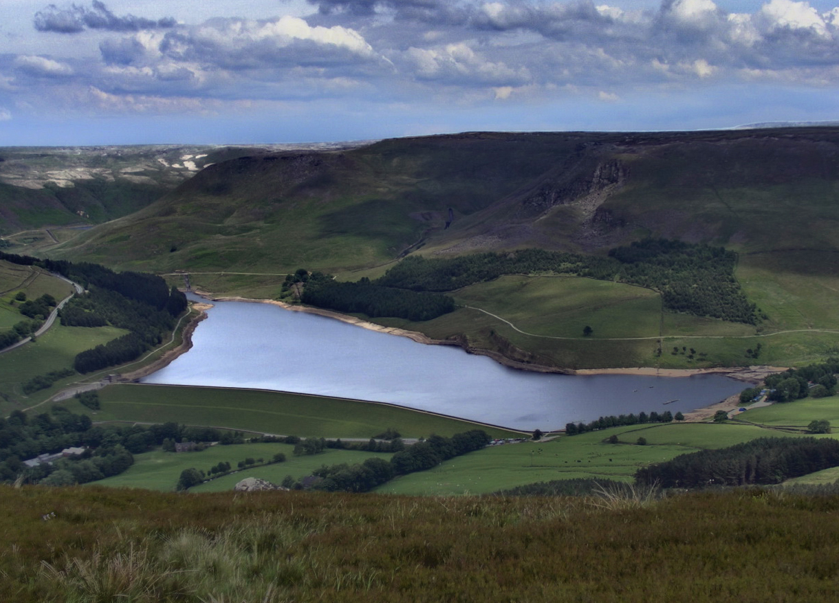
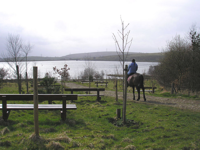
| Dovestone Reservoir | 3.7 miles (6 km) | Enjoy an easy circular walk around this lovely reservoir on Saddleworth Moor. The reservoir is located a few miles east of Oldham on the edge of the Peak District. There is a well maintained footpath running around the reservoir. There is also the option of continuing north along the water to Yeoman Hey Reservoir and Greenfield Reservoir where there are views of the Greenfield Brook. You can also follow the Oldham Way east to the nearby Chew Reservoir. The area is very popular with walkers as the reservoir is surrounded by attractive countryside, woodland and gritstone crags. Also look out for pretty waterfalls at Dovestone Clough near the dam. There is some climbing on the Chew Hills at the southern end of the water but you are rewarded with great views across the reservoir. This route starts from the car park at the south western end of the reservoir but you could also catch the train to nearby Mossley and follow the Oldham Way to the water. If you would like to extend your walk then you could climb to Great Dovestone Rocks located on the eastern side of the reservoir. The rocks are a fascinating geological feature and give great views over the Peak District. Our Dovestone Rocks circular walk starts from the same car park and also visits Chew Reservoir. View Full Details>> | |
| Dovestone Rocks | 6.2 miles (10 km) | This walk climbs to a series of wonderful viewpoints overlooking Dovestone Reservoir in the dark peak area of the Peak District. The challenging route runs for just over 6 miles, visiting the Ashway Stone, Dean Rocks, Great Dovestone Rocks and Chew Reservoir. Start the walk from the car park at the northern end of Dovestone Reservoir. From here you can pick up a path running east between the reservoir and the adjacent Yeoman Hey Reservoir. The path then climbs to the Ashway Stone before turning south to Dean Rocks and Great Dovestone Rocks. This section climbs to a height of over 1550ft with magnificent views over the surrounding reservoirs and peaks. There's also a series of striking rock formations so be sure to have a camera handy here. The route continues south past Bramley's Cot before descending to Chew Reservoir. There's nice views across the water as you skirt the western edge. The route then turns north west to climb toward Dish Stone Rock and the Chew Hills. Here you pick up the Oldham Way long distance trail to pass along the eastern edge of Dovestone Reservoir. This will lead you back to the northern end of the water and the car park. View Full Details>> | |
| Dunham Massey | 3.1 miles (5 km) | This is a splendid circular walk around the impressive grounds of Dunham Massey Hall, in Altrincham, Greater Manchester. View Full Details>> | |
| Elton Reservoir | 1.6 miles (2.5 km) | Enjoy an easy circular walk around this pretty reservoir in Bury. It's a nice path with good views across the water where you'll often see little sailboats. The reservoir is also surrounded by some nice rolling countryside and woodland. View Full Details>> | |
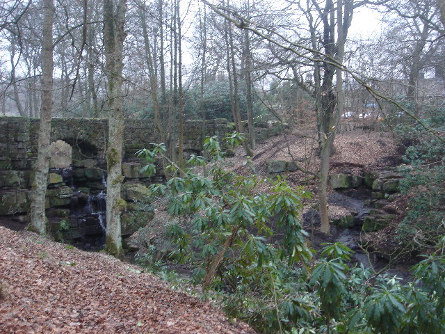
| Etherow Country Park | 3.7 miles (6 km) | Enjoy a stroll along the River Etherow and around the large reservoir in this pretty country park near Marple and Stockport. The park also includes a mill pond, a picturesque waterfall, bluebells in Ernocroft Wood and the 32 acre Compstall Nature Reserve. The lake is a good spot for birdwatching with several species of wildfowl regular visitors to the area. The Etherow Goyt Valley Way and the Goyt Way walking routes run through the park so there is scope for continuing your walk on these trails. View Full Details>> | |
| Etherow Goyt Valley Way | 13.7 miles (22 km) | The Goyt Valley is an excellent place for walks with fine riverside trails along the Rivers Goyt and Etherow. There's also a number of pretty reservoirs and splendid views of the Peak District hills. This walk takes you through the beautiful valley from Stockport to Hadfield along the waymarked Etherow Goyt Valley Way. If you'd like to explore the Upper Goyt Valley then see the Errwood Reservoir and Fernilee Reservoir Walk. This will take you along two lovely reservoirs near Whaley Bridge. This path starts in Vernon and Woodbank Park on the River Goyt in Stockport and follows the river to Etherow Country Park near Marple. This is a lovely section with a reservoir, woodland and a variety of wildlife to enjoy. The walk then joins the River Etherow following it to Broadbottom and then onto Bottoms Reservoir in Hadfield. There is a challenging climb near Broadbottom on this route but with fantastic views over the surrounding area. View Full Details>> | |
| Fletcher Moss Park | 0.6 miles (1 km) | Fletcher Moss is a beautiful botanical garden located in Didsbury, Manchester. The gardens contain a wide range of ornamental trees and shrubs, including Chusan palms, tulip trees, mulberry, dawn redwood and various dwarf conifers. There are also pretty rock gardens, little waterfalls and ponds. The gardens attract a wide variety of birdlife so you can sit enjoy the birdsong for a while. A short walk from Fletcher Moss takes you to the adjacent Parsonage gardens where you will find several large yew trees and pretty flower beds. The Trans Pennine Trail runs past the park so you could pick this up and enjoy a walk along the River Mersey. Stenner Woods nature reserve is also right next to the park so this is another good option if you'd like to extend your walk. View Full Details>> | |
| Glazebrook Trail | 9.9 miles (16 km) | This easy trail follows Glaze Brook from Pennington to Cadishead. The trail starts in the lovely Pennington Flash Country Park in Leigh. This nature reserve has a 173 acre lake and is home to a variety of birdlife. You then follow Glaze Brook and Pennington Brook south to Glazebury and then onto Cadishead on the Manchester Ship Canal. View Full Details>> | |
| Goyt Way | 9.9 miles (16 km) | Follow the Goyt Way along the Peak Forest Canal and the River Goyt on this lovely waterside walk through Greater Manchester and Derbyshire. The walk starts by Etherow Country Park Lake in Compstall and heads south through Marple and New Mills to Whaley Bridge. The first section through Marple follows the towpath of the Peak Forest Canal, passing pretty locks on the way. You then join the River Goyt to New Mills before picking up the Canal again near Whaley Bridge where the route finishes. The final section through New Mills passes the wonderful Torrs Riverside Park and Millennium Way, a beautiful river gorge with a fabulous 160 metre long walkway elevated over the water. View Full Details>> | |
| Greenbooth Reservoir | 1.9 miles (3 km) | Enjoy a circular walk around Greenboth Reservoir and the Naden Reservoirs on this route in the Rochdale area of Greater Manchester. It's a lovely, peaceful area with nice views towards Manchester and the nearby Scout Moor Wind Farm, the highest point of the Rossendale Valley. With four reservoirs to walk to and great views of the surrounding moorland scenery there's plenty to see in the area. View Full Details>> | |
| Haigh Hall Country Park | 2.2 miles (3.5 km) | Enjoy a pleasant walk around this large country park near Wigan in Greater Manchester. View Full Details>> | |
| Hartshead Pike | 2.2 miles (3.5 km) | Climb this hill in Greater Manchester for great views over Ashton-under-Lyne, Mossley and Oldham. At the summit you will find the 19th century Hartshead Pike Tower, a Grade II Listed building. From the 267 m (876 ft) summit you can enjoy views over the Pennine Hills, the city of Manchester and even Snowdonia in Wales on a clear day. The circular walk starts near Mossley train station and climbs past Luzley Brows and Luzley Hall to Mossley Cross. You continue to Hartshead Pike before descending back to the town via Broad Carr. If you would like to continue your walking in the area then you could pick up the Oldham Way which runs past Hartshead Pike. You could also pick up the Tame Valley Way and enjoy a walk along the River Tame through Mossley. You can also pick up the Huddersfield Narrow Canal and head across the Pennines and the Peak District towards Huddersfield. View Full Details>> | |
| Healey Dell | 1.9 miles (3 km) | This circular walk explores a lovely little nature reserve in Whitworth. At the site you can explore lots of nice footpaths through a densley wooded valley. There's the rushing water of the River Spodden with pretty waterfalls and lots of wildlife to look out for. The site also includes water mills, picnic areas and the impressive 1867 Healey Dell Viaduct. The reserve has good facilities with a visitor centre providing lots of helpful information and a nice cafe. The reserve is in a great location for extending your walking in the area as there are number of waymarked footpaths to pick up. If you head west you can climb to Hunger Hill and Forsyth Brow before coming to Greenbooth Reservoir. The Rochdale Way and Pennine Bridleway pass the reserve so you can follow these paths across the surrounding Pennine Moors. View Full Details>> | |
| Heaton Park | 3.1 miles (5 km) | Enjoying cycling and walking in this huge park in Prestwich, Manchester. View Full Details>> | |
| Highfield Country Park | 1.9 miles (3 km) | This 70 acre park is also a local nature reserve with a number of country walks and a cycle track. It is located in Levenshulme in Manchester - a short walk from the train station. View Full Details>> | |
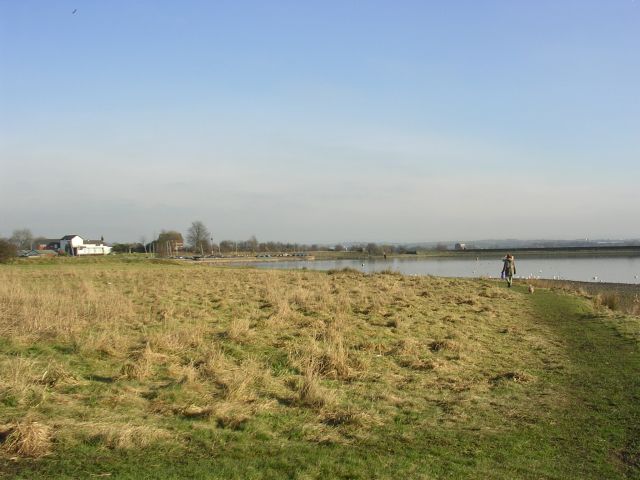
| Hollingworth Lake | 1.9 miles (3 km) | Enjoy a lovely circular walk around this 130 acre reservoir in Littleborough. There is some beautiful scenery surrounding the lake and a nature reserve with a bird hide. You can also try kayaking and windsurfing on the lake with equipment available for hire. View Full Details>> | |
| Irwell Sculpture Trail | 29.8 miles (48 km) | Follow the River Irwell on this splendid waterside walk through Greater Manchester and enjoy over 70 artworks by renowned artists. The walk starts at Salford Quays and follows the trail north through Radcliffe, Bury and Ramsbottom towards Bacup. View Full Details>> | |
| Jumbles Country Park | 1.9 miles (3 km) | Enjoy a short stroll around Jumbles Reservoir in this pretty country park in Bolton. The park is set within the beautiful West Pennine Moors with a lovely waterside footpath around the reservoir. There are also good facilities with a visitor centre and cafe. The park is located just a couple of miles north east of Bolton city centre, near to the Lancashire village of Chapeltown. If you have time you could continue your walk along the Witton Weavers Way to the nearby Wayoh Reservoir and Nature Reserve. View Full Details>> | |
| Ladybrook Valley Interest Trail | 9.9 miles (16 km) | This walk follows various brooks from Cheadle to Disley via Hazel Grove. You start off at Abney Hall Park in Cheadle. The park has lovely grounds and the interesting Abney Hall built in 1847 and makes for a fine start point. From here you follow the Micker Brook to the grand Brammall Hall. Bramall Hall is one of Cheshire's grandest black and white timber-framed Tudor manor houses and also has 70 acres of beautiful parkland. The trail then joins the Lady Brook, following it to Poynton Park in Hazel Grove where you will walk alongside the attractive Poynton Lake. The final section takes you along Norbury Brook to Middlewood, before crossing the Macclesfield Canal and finishing at Disley. View Full Details>> | |
| Leeds and Liverpool Canal | 126.1 miles (203 km) | Enjoy waterside cycling and walking along Britain's longest single canal. It runs for 126 miles across the Pennines, passing many villages, towns and cities with a fascinating heritage and industrial history. There are also umpteen pretty locks, viaducts and some wonderful countryside to enjoy. Walkers can enjoy the whole route from Leeds to Liverpool, while there are several sections for cyclists too. If you are on a bike then you can follow Sustrans National Cycle Route 66 from the start at Leeds to just outside Silsden. There's another Sustrans section around Barnoldswick and from Nelson to Burnley in Lancashire. The section from Chorley to Adlington is also open to cyclists. Highlights on the route include the impressive 5 rise locks at Bingley, Wigan Pier and the lovely Foulridge Reservoir in Colne. Near Burscough you'll pass the wonderful Martin Mere Nature Reserve where you can look out for otters, flamingos, beavers and thousands of water loving birds. View Full Details>> | |
| Leigh | 6 miles (9.6 km) | This town in Greater Manchester has some nice canalside walks and a fine local country park and nature reserve to explore on foot. In the historic town centre there's also some interesting Edwardian and Victorian terraced housing and several listed mills to see. View Full Details>> | |
| Littleborough | 10.6 miles (17 km) | The town of Littleborough has a lot of great options for walkers visiting the region. It is nicely located in the upper Roch Valley by the foothills of the South Pennines. There's several waymarked trails, hill climbs, reservoirs and a canal running through the area. This circular walk visits several of the highlights of the area using a some of the waymarked trails that circle the town. The walk starts at the train station which lies on the Caldervale Line 13ľ miles (22 km) north of Manchester Victoria towards Halifax, Bradford Interchange and Leeds. From here you can pick up the Station Walk and follow it south to visit Hollingworth Lake. The lake is a popular local attraction with a waterside trail and lots of wildlife to look out for on the water. The route then picks up a section of the Pennine Bridleway, following it east towards Longdon Clough. The route then follows a different bridleway up to Windy Hill and Rook Stone Hill, where you pick up the Pennine Way National Trail. This will take you north to another highlight of the area at Blackstone Edge. This geologically significant gritstone escarpment commands wonderful views over Greater Manchester and Yorkshire. The path will take you north along the Edge to Blackstone Edge Reservoir where there's some more nice waterside trails. At the resevoir you continue west and then north around the Chelham Reservoirs before picking up the Rochdale Canal. You can then follow the towpath south back to the train station. View Full Details>> | |
| Macclesfield Canal | 26.1 miles (42 km) | Follow the towpath of the Macclesfield Canal from Marple to Kidsgrove on this waterside walk in Cheshire. Along the way there's lots of interesting lock structures, old bridges, pretty villages, nice pubs and great views of the surrounding Cheshire countryside. The 27 mile canal runs from Marple in Greater Manchester to Kidsgrove in Staffordshire, where it links with the Trent and Mersey Canal. You start of at Marple Canal Locks near to Marple train station. It's a wonderful start to the walk with the fascinating flight of sixteen locks a truly impressive sight. The canal then heads south through the town before branching off to the south west while the adjacent Peak Forest Canal branches off to the south east towards Disley. The canal continues south towards Middlewood and Bollington, before entering Macclesfield itself. After passing through the eastern edge of the town you head out into the countryside again, passing Bosley Locks before coming to Congleton. The Bosley locks are one of the highlights of the route with an impressive flight of twelve canal locks. The final section runs from Congleton to Kidsgrove where the canal links with the Trent and Mersey Canal. The canal is one section of the Cheshire Ring Canal Walk which follows six historic canals through Cheshire, Greater Manchester and Staffordshire. Along the route of the canal there's plenty of opportunities to make short detours and visit some of the area's attractions. For example, around Congleton you can visit the lovely Astbury Mere Country Park and enjoy a waterside walk around the pretty lake. Around Bosley you will find Bosley Reservoir and the climb to Bosley Cloud. Also of interest is the Middlewood Way. View Full Details>> | |
| Macclesfield to Marple - Middlewood Way | 11.2 miles (18 km) | Follow the Middlewood Way - a lovely off road cycle and walking path running from Macclesfield to Marple and passing by the Macclesfield Canal. View Full Details>> | |
| Marple Canal Locks | 1.2 miles (2 km) | This easy walk takes you along a particularly lovely section of the Peak Forest Canal in Marple. You'll pass the Marple Lock Flight consisting of a flight of sixteen canal locks over the course of about 1 mile. It's a splendid sight with lots of boats to see in the summer months and nice views of the surrounding countryside. The walk starts from Marple Memorial Park where there's a car park, tree sculptures, sensory gardens and nice views towards the Peak District hills. From the car park follow footpaths leading down to the canal where you can pick up the towpath and head north, passing the lock flight. The walk passes Brabyn's Park before finishing at Marple Aqueduct. The structure was built to carry the lower level of the Peak Forest Canal across a length of the River Goyt. It is the highest canal aqueduct in England and the highest masonry-arch aqueduct in Britain. You can extend the walk by continuing along the Etherow Goyt Valley Way which will take you west along the river towards Bredbury. Etherow Country Park is also very close by. There's more nice waterside trails along the River Etherow here. The Macclesfield Canal also starts at the locks. You can follow it south through the countryside towards Bollington and Macclesfield. View Full Details>> | |
| Medlock Valley Way | 12.4 miles (20 km) | Follow the Medlock Valley Way from Manchester City Centre to Bishop Park near Oldham on foot or take your bike for the first section to Clayton Vale. You start off near Piccadilly station and head east along the River Medlock, passing Manchester City Football Stadium and Phillips Park before entering a lovely section of parkland and woodland through Clayton Vale. The reserve is home to a number of excellent mountain bike trails run by the National Cycling Centre. The route continues past Droylsden and the pretty Daisy Nook Country Park with the final section taking you past the pretty reservoirs in Strinesdale Country Park to Bishop Park. View Full Details>> | |
| Mellor | 3.1 miles (5 km) | This circular walk takes you up to the Mellor Cross on Mellor Moor in Greater Manchester. View Full Details>> | |
| Moses Gate Country Park | 3.1 miles (5 km) | This large country park in Bolton covers 750 acres and includes a number of splendid cycling and walking trails. The River Croal and River Irwell run through the park and there are 3 pretty lakes, so there is some lovely waterside walking and cycling to enjoy. The park is excellent for bird watching with a bird hide next to one of the lakes. Facilities in the park include a visitor centre and some excellent play areas for children. The park is located just a few miles south of Bolton next to Moses Gate train station. If you would like to continue your walking in the area then you could head a couple of miles south and visit Blackleach Country Park. Here you'll find a nice walking trail along a pretty lake with lots of birdlife to look out for. Also nearby is Clifton Country Park. Located alongside the River Irwell the park contains walking and cycling trails with features including a pretty lake, woodland, meadows and an arboretum. View Full Details>> | |
| North Cheshire Way | 70.2 miles (113 km) | Starting at Hooton Station, near Ellesmere Port, follow the North Cheshire Way through Frodsham, Northwich, Knutsford and Wilmslow to the finish point at Disley. Highlights on the walk include:
| |
| Ogden Reservoir and Piethorne Reservoir | 3.1 miles (5 km) | Explore this area of the Piethorne Valley on this circular walk in the Metropolitan Borough of Rochdale, Greater Manchester. There's a nice walking trail taking you around Ogden Reservoir, Kitcliffe Reservoir and Piethorne Reservoir. You'll climb above the reservoirs and enjoy wonderful views over the surrounding countryside. There's also waterfalls, woodland and lots of wildlife to look out for on the way. View Full Details>> | |
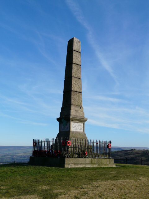
| Oldham Way | 39.8 miles (64 km) | Enjoy the canals, reservoirs and countryside around Oldham on this splendid circular walk. There's fabulous views of the Peak District with highlights including a visit to Saddleworth Moor and a climb to the 19th century tower on Hartshead Pike. There's also nice waterside stretches along Dovestone Reservoir and Greenfield Reservoir. Near here you will pass Alphin Pike and cross the noteworthy Pots and Pans. The hill includes interesting rock formations, an obelisk war memorial and fine views to Manchester. View Full Details>> | |
| Orrell Water Park | 1.1 miles (1.8 km) | This park in the Orrell area of Greater Manchester includes two pretty reservoirs surrounded by attractive woodland and a buttercup meadow. There's nice easy footpaths to follow around the water with lots of wildlife to look out for on the way. View Full Details>> | |
| Outwood Trail | 4.3 miles (7 km) | This cycling and walking trail runs along a disused railway line from Radcliffe to Prestwich. The route starts in Outwood Country Park in Radcliffe, next to the River Irwell. You then follow the surfaced path through Giant's Seat Wood and Hurst Wood passing Clifton Country Park on the way. You can continue along the traffic free path on National Cycle Route 6 through Prestwich Forest Park to Pendlebury. It's an easy, traffic free ride through pleasant woodland and parkland. View Full Details>> | |
| Owd Betts Ashworth Moor Reservoir | 1.2 miles (2 km) | Enjoy a short, waterside walk around Ashworth Moor Reservoir from Owd Betts pub in Rochdale. The walk starts from the Owd Betts car park on the Edenfield Road, just to the north west of Rochdale. The 18th century pub has an interesting history and is a great place for refreshments after your walk. From the car park you can pick up an easy footpath leading around the water for just over a mile. After you finish your exercise you can enjoy a lovely pub lunch at Owd Betts where there's outdoor seating with wonderful views over the surrounding hills of the South Pennines. View Full Details>> | |
| Peak Forest Canal | 14.9 miles (24 km) | Travel from Derbyshire into Greater Manchester on this waterside walk along the Peak Forest Canal. The route runs from Buxworth in Derbyshire to Ashton-under-Lyne in Greater Manchester. On the way you'll pass a series of pretty locks with nice views of the surrounding countryside. It's about a 15 mile walk from end to end. You start off in the village of Buxworth at the restored Bugsworth Basin which was used to to carry limestone to the canal in the 18th and 19th centuries using the Peak Forest Tramway Trail. You could also start from the nearby Whaley Bridge Basin if you prefer. The first section then heads north towards Bridgemont and New Mills with views of the River Goyt. Around New Mills you can visit the splendid Torrs Riverside Park and Millennium Way. Here you will find a beautiful river gorge with a fabulous 160 metre long walkway elevated over the water. Soon after New Mills you come to Disley where you can take a small detour and visit the wonderful Lyme Park. The expansive deer park has great views of the surrounding Peak District Hills. The canal continues north through Marple where you will come to the impressive Marple Aqueduct and a flight of sixteen locks. It's one of the highlights on the walk and a nice spot to stop for some refreshments. The next stage runs through Romiley and Hyde before finishing at Ashton-under-Lyne where it links with the Ashton Canal. View Full Details>> | |
| Peel Tower | 8.1 miles (13 km) | This walk climbs to the Peel Monument on Holcombe Hill in Ramsbottom near Bury. The tower is dedicated to Sir Robert Peel, the 19th century Prime Minister considered the father of modern British policing. The impressive landmark stands at a height of 1,100 feet (335 m) above sea level, commanding wonderful views over the surrounding countryside and towns. View Full Details>> | |
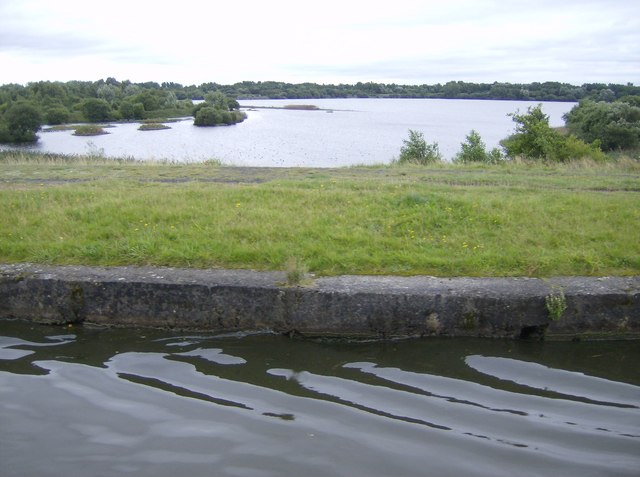
| Pennington Flash Country Park | 3.7 miles (6 km) | This 490 acre park is located in Leigh, Greater Manchester. The main feature is the 170 acre lake which is now a nature reserve with a number of bird hides. Over 200 bird species have been spotted at the park such as Black-faced Bunting, Nightingale, Marsh Harrier, Spoonbill and Leach's Storm-petre.
The park has a number of well maintained paths suitable for cyclists or walkers. Facilities include an information centre, mobile cafe and nine hole golf course. The Bridgwater Canal also passes through the park so you can continue your walk/cycle along the towpath if you have time. View Full Details>> | |
| Portland Basin | 6.8 miles (11 km) | The Portland Basin is situated next to several canals and a river making it a great place to start a walk. This route takes you along the Peak Forest Canal and the Tame Valley Way to the south of the basin. The walk starts from the Portland Basin museum on Ashton-under-Lyne, Greater Manchester. From here you can pick up a waymarked trail heading south along the canal past Dukinfield and Hyde. Here you cross the canal to Haughton Green and turn north along the Tame Valley Way. The riverside path heads through Kingston before linking with the canal again. A short stretch along the towpath then takes you back to the museum. View Full Details>> | |
| Prestwich Forest Park | 3.1 miles (5 km) | Enjoy a peaceful walk or cycle in this pretty country park in Bury. The park covers an area of approximately 500 acres and includes some lovely woodland trails and a waterside path along the River Irwell. Prestwich Forest is located on the Irwell Sculpture Trail and right next to Clifton Country Park so there is scope for continuing your outing if you have time. View Full Details>> | |
| Radcliffe Canal Walk | 2.5 miles (4 km) | This walk takes you along the Manchester Bolton & Bury Canal in the town of Radcliffe in Greater Manchester. View Full Details>> | |
| Ramsbottom | 4 miles (6.5 km) | A circular walk around Ramsbottom visiting some of the highlights of the area including River Irwell, Nuttall Park, Holcombe and the iconic Peel Tower. The walk starts from the train station and heads a short distance to the east to pick up the Irwell Sculpture Trail. Follow the path south and you will soon come to Nuttall Park where there's nice views of the surrounding hills, tree lined footpaths, river views and a series of sculptures. After exploring the park you continue south along the river to Brooksbottoms. Here you turn west to follow woodland trails towards Hazelhurst where you start to climb towards Peel Tower. View Full Details>> | |
| Reddish Vale Country Park | 1.9 miles (3 km) | This 400 acre park lies just a couple of miles north of Stockport in the Tame Valley. The park contains a Visitor Centre, Community Orchard and Garden, Butterfly Conservation Field and a Dipping Pond. There are also peaceful woodland walks, a waterside path along the River Tame and two reservoirs which attract plenty of wildlife. For children there's a farm where you can pet and feed a variety of animals. Both the Trans Pennine Trail and the Midshires Way run through the park. View Full Details>> | |
| Rochdale Canal | 32.9 miles (53 km) | Follow the Rochdale canal from Manchester to Sowerby Bridge on this waterside route through Greater Manchester and Yorkshire. It starts in the city centre of Manchester and runs for about 33 miles through the Pennine Hills. The canal is an excellent way to see the Pennines without too much effort as the towpath is largely flat. You start off in Manchester just to the north of Piccadilly train station at the Castlefield Basin. The canal then heads to Rochdale passing through Failsworth and Chadderton on the way. Near Rochdale you will pass the lovely Hollingworth Lake which is worth a small detour. The route continues through Littleborough to Todmorden where there is the opportunity to visit Stoodley Pike. The challenging climb to the monument gives gives great views over the surrounding area. The next section runs from Todmorden to Hebden Bridge giving wonderful views of Calderdale and the Pennine Hills. If you have time you could visit the wonderful Hardcastle Crags just north of Hebden Bridge. Here you will find streams, beautiful waterfalls and the fantastic Gibson Mill. The final stretch runs from Hebden Bridge to Sowerby Bridge passing the pretty village of Mytholmroyd. The canal then joins the Calder and Hebble Navigation Canal which is also great for a walk or cycle. View Full Details>> | |
| Rochdale Way | 44.7 miles (72 km) | A fabulous circular walk around Rochdale which visits a series of lovely reservoirs and includes a section along the River Roch. The walk visits Blackstone Edge, Healey Dell, Knowl Hill, Ashworth Moor Reservoir, Greenbooth Reservoir and the Ashworth Valley where there's nice trails along the Naden Brook and the Cheesden Brook. Other highlights include Tandle Hill Country Park, Alkrington Woods, Queens Park and the Ogden and Piethorne Reservoirs in the Piethorne Valley. View Full Details>> | |
| Rossendale Way | 41 miles (66 km) | This circular walk takes you on a tour of the lovely Rossendale area of Lancashire and Greater Manchester. The path passes Haslingden, Rawtenstall, Whitworth, Stubbins and Healey with a series of attractive reservoirs including Cowpe and Calf Hey real highlights. Near Calf Hey you'll cross Holcombe Moor where you'll pass Musbury Tor and the Peel Tower. The distinctive monument is dedicated to Sir Robert Peel, the 19th century Prime Minister considered the father of modern British policing. It's a major local landmark and worth the climb to the top for the views over the area. The walk also takes you through the delightful Healey Dell Nature Reserve with waterfalls and wildlife to enjoy here. View Full Details>> | |
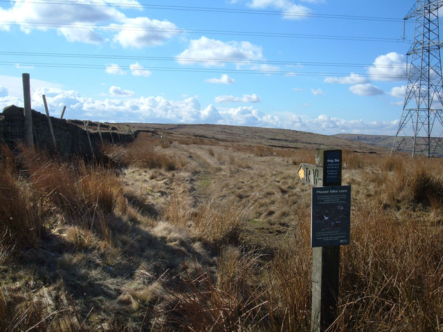
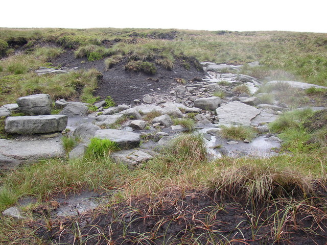
| Saddleworth Moor | 5 miles (8 km) | Enjoy a walk across this atmospheric moor in the Peak District. You can start at the car park at Dovestone Reservoir and follow footpaths past Yeoman Hey Reservoir and Greenfield Reservoir. You then follow the Greenfield Brook to Raven Stones Brow with little waterfalls to enjoy on the way. After crossing the brook you then head up and across the moor. This is a challenging section with the moor reaching heights of around 1500ft. There are excellent views over the reservoirs to the surrounding Pennine Hills and some fascinating geological features to look out for on the way. From the high point on the moor you descend to Dovestone Reservoir and enjoy a woodland and waterside section taking you back to the car park. To extend your walk you can pick up the Oldham Way and follow it south over the Chew Hills to Chew Reservoir. You could also reach the moor from nearby Mossley train station by following the Oldham Way. View Full Details>> | |
| Salford Trail | 31.1 miles (50 km) | This circular walk explores the city of Salford on a long distance waymarked trail. View Full Details>> | |
| Smithills Country Park | 2.2 miles (3.5 km) | Enjoy 2000 acres of cycling and walking trails in this large country park in Bolton. The parkland surrounds the Grade 1-listed Smithills Hall with a history dating back to the 14th century. Smithills includes lakes, woodland, farmland and moorland with superb views of the West Pennine Moors. View Full Details>> | |
| South Pennine Water Trail | 5 miles (8 km) | This circular walk around Littleborough includes waterside trails along Hollingworth Lake and the Rochdale Canal. There's lovely views of the Ealees Valley and the hills of the South Pennines to enjoy on the way. It's a fairly flat walk with some moderate climbing toward the end, so a reasonable level of fitness is required. The walk starts from the car park and visitor centre at Hollingworth Lake but you could also start from Littleborough or Smithy Bridge train stations which are also on the route. The first section follows part of the Rochdale Way around the lake. The 130 acre reservoir is a scenic spot and also a nature reserve with lots of wildlife to look out for on the water. The route then heads south into the countryside around Bib Knowl where you turn west toward Clegg Hall and the canal. The striking 17th-century hall is a Grade II listed building and sits next to the canal in a picturesque location. Here you pick up the canal towpath and follow it north past Smithy Bridge toward Littleborough. The little town is well worth exploring, with a number of interesting buildings and shops to see. At Littleborough you leave the canal and turn east, following a path along the Ealees Brook in the pretty Ealees Valley. You'll pass the little hamlet of Whittaker where there are a number of interesting stone houses and fine views up to the dramatic escarpment of Blackstone Edge. The final section runs south past Clegg's Wood to return you to the car park. View Full Details>> | |
| Stalybridge Country Park | 4.3 miles (7 km) | This country park contains several large reservoirs and some beautiful open moorland. It is ideal for walking and cycling with the super Pennine Bridleway and the Tame Valley Way both passing through the park. You can stay in the lower part of the Brushes Valley and around Carrbrook for flatter, well surfaced paths or climb to Wild Bank where there are fabulous views of the Pennine Moors. The waterside stretch along Walkerwood Reservoir, Brushes Reservoir and the Swineshaw Reservoirs is particularly lovely. The park is located a couple of miles east of the centre of Stalybridge. View Full Details>> | |
| Stockport | 4.3 miles (7 km) | The town of Stockport is located to the south of Manchester. There's some nice riverside trails along the rivers that run through the town. There's also some good local parks with surfaced footpaths to try. View Full Details>> | |
| Stockport Heritage Walk | 2.2 miles (3.5 km) | This walk follows the Woodbank Memorial Park Nature and Heritage Trail in Stockport, linking riverside woodland and historic parkland along the River Goyt. The route passes through Woodbank Memorial Park and continues towards the Poise Brook Local Nature Reserve, connecting two areas recognised locally for their wildlife and natural features. View Full Details>> | |
| Strinesdale Reservoir and Country Park | 1.2 miles (2 km) | This circular walk explores the Strinesdale Country Park and reservoirs in Oldham. View Full Details>> | |
| Tame Valley Way | 23 miles (37 km) | Follow the River Tame through Greater Manchester from Stockport to Denshaw on this waterside walk. The trail passes through Ashton-under-Lyne, Stalybridge and Mossley and includes woodland sections as well as the extended sections along the River Tame and Huddersfield Narrow Canal. Also of interest is Reddish Vale Country Park, which sits right on the River Tame. View Full Details>> | |
| Tandle Hill Country Park | 1.9 miles (3 km) | Explore 110 acres of beech woodland and open grassland in this country park in Royton. At the highest point in the park there is a war memorial commemorating the men of Royton who died during the First World War. There are also views across the Manchester Plain and the Pennine Hills. Facilities include a cafe and a Countryside Centre with leaflets and information displays on the local area, wildlife and countryside. There are two way-marked walking trails in the park. The green trail follows well surfaced paths and is suitable for wheelchairs and pushchairs. The blue trail is more hilly and not suitable for wheelchairs and pushchairs. The Thornham cycle trail also passes through the park and offers a nice ride on well layed out paths. You could also continue your walk along the Rochdale Way which runs through Tandle Hill. View Full Details>> | |
| Trans Pennine Trail | 215 miles (346 km) | This terrific walking and cycling trail runs from coast to coast across northern England entirely on surfaced paths. It starts on the Yorkshire coast at Hornsea and passes through Yorkshire, Derbyshire and Greater Manchester before finishing on the Merseyside coast at Southport. View Full Details>> | |
| Uppermill | 10.2 miles (16.4 km) | The pretty village of Uppermill is in a lovely location on the Huddersfield Narrow Canal and the River Tame. It's also located close to the South Pennines and the Peak District making it an excellent base for walking. View Full Details>> | |
| Vernon and Woodbank Park | 2.5 miles (4 km) | These two parks sit side by side near Stockport town centre. They have nice walking trails along the River Goyt, woodland trails, ponds with wildlife and well laid out gardens. From the high points in the park there are nice views towards the Peak District hills. The Stockport Heritage Walk, the Midshires Way and the Etherow Goyt Valley Way both run through the park so you can pick these up to extend your walking in the area. View Full Details>> | |
| Walkerwood Reservoir | 1.2 miles (2 km) | This circular walk takes you around Walkerwood Reservoir in Stalybridge Country Park. It's easy walking with nice views of the Pennine Moors and the surrounding hills. There's a car park at the north western corner of the reservoir on Brushes Road where you could start the walk. From here you can pick up footpaths taking you around the water. The path runs for just over 1 mile, though you could extend the walk by following the Pennine Bridleway east to Brushes Reservoir and the Swineshaw Reservoirs. If you were to head south from the site you could visit a series of reservoirs running along the Longdendale Trail. View Full Details>> | |
| Watergrove Reservoir | 1.9 miles (3 km) | Enjoy a circular walk around the pretty Wardle reservoir in Greater Manchester. There's a car park at the southern end of the water on Ramsden Road where you can pick up the footpath around the water. The reservoir is surrounded by attractive moorland with great views across Manchester to the Cheshire plain. View Full Details>> | |
| Werneth Low Country Park | 2.5 miles (4 km) | Enjoy fantastic views across Manchester and the Pennine Hills in this 200 acre country park. On a clear day the hills of North Wales are also visible beyond the Cheshire plain. In the park there are well surfaced footpaths and bridleways suitable for mountain biking. The Cown Edge Way and the Trans Pennine Trail both run through the park so there is scope for continuing your walk/cycle. View Full Details>> | |
| Wigan Canal Walk | 6 miles (9.7 km) | An easy walk along the Leeds and Liverpool Canal from Wigan to Parbold. It's a lovely section of the canal with lots of locks, views of the River Douglas and interesting old buildings. At the end of the route you can catch the train back from Parbold to Wigan directly. View Full Details>> | |
| Worsley Canal Walk | 8.1 miles (13 km) | A walk along the Bridgewater Canal from Worsley to Leigh, where you can finish the walk with a visit to Pennington Flash Country Park. The walk starts at the canal basin near to the south western end of Worsley Woods. Around here you can see the 18th century Worsley Packet House which sits next to the canal in a picturesque location. View Full Details>> | |
| Worsley Woods | 2 miles (3.2 km) | This circular walk around Worsley uses a series of public footpaths to explore these pretty woods in Salford. There's shady trails, streams, a lake, sculptures and a wild flower trail to enjoy. View Full Details>> | |
| Wythenshawe Park | 1.6 miles (2.5 km) | Enjoy walking and cycling in this large park in Manchester. The park has miles of nice walking trails while National Cycle Network Route 85 also runs through it. View Full Details>> |